Drone as a Service offers clients an unparalleled vantage point and payload solutions that accelerate progress towards every operational goal.
ALTITUDE IS ADVANTAGE
Drone as a Service enables clients to access essential business intelligence and aerial tools, including:
Aerial surveying and mapping
3D Modeling
High-resolution videography and photography
Radar imaging
Operations planning
Payload delivery
Safety compliance and risk reduction
END-TO-END DATA MANAGEMENT
Want aerial intelligence to improve operations, but unsure if you can interpret or manage the data? Our solutions include expert, end-to-end data management, from mission planning to data processing and analysis, to help you make the most of our drone intelligence.
GET MORE FOR LESS—QUICKLY
With Drone as a Service, you avoid the capital costs of drone ownership and the inconvenience of hiring pilots and obtaining regulatory approvals—while still accessing the very latest drone technology and data insights. Our drones can map a 200-acre site in a single day—a task that would take a traditional survey crew a week or more to complete.
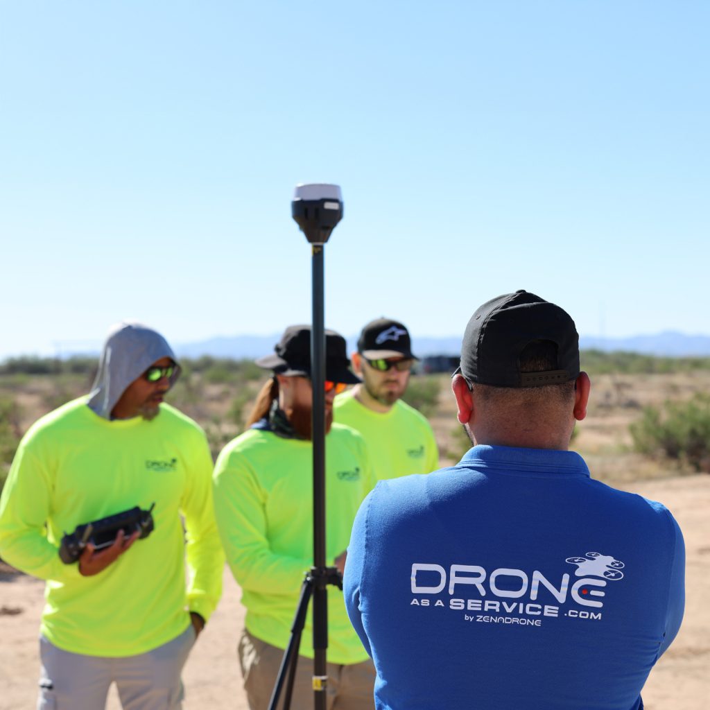
OUR DRONES
Our fleet can effortlessly access anywhere you need to be to optimize project success, and are purpose-built to handle every task. Our drones incorporate machine learning, AI, and other software and hardware innovations to provide real-time and predictive solutions.
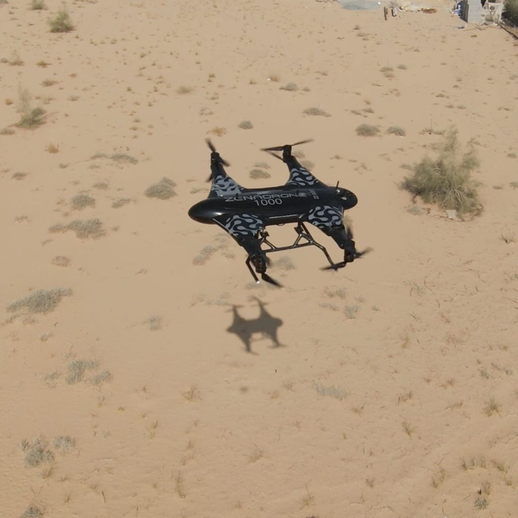
The ZenaDrone 1000 features exceptional maneuverability, stable flight characteristics, heavy-lift capability, and 1-hour flight time. Its onboard AI, 4K cameras, thermal imaging, LiDAR, and multispectral sensors provide rich data-capture in the field. With a weather-durable, carbon-fiber body, custom power-management system, emergency backup, internal storage, retractable landing gear, and emergency parachute, the ZenaDrone 1000 ensures reliable operation in every scenario.
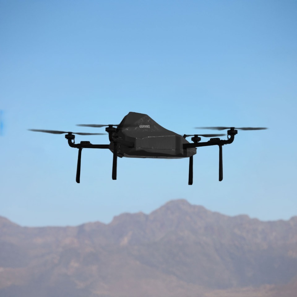
ZENADRONE IQ QUAD
The ZenaDrone IQ Quad is an AI-autonomous, industrial-grade quadcopter, purpose-built for precision surveying. The IQ Quad is optimized to carry high-resolution 4K cameras, LiDAR, and multispectral and thermal sensors to provide extremely detailed images and 3D maps and models across diverse scenarios and industries. Featuring advanced obstacle detection, terrain-following sensors, and 360° situational-awareness cameras, the IQ Quad delivers comprehensive insights with high operational efficiency.
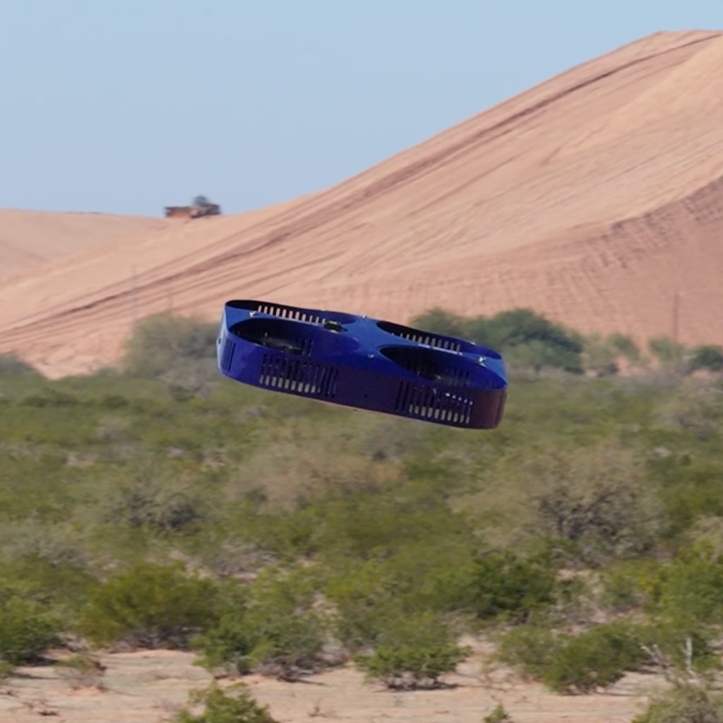
ZENADRONE IQ SQUARE
The ZenaDrone IQ Square is a multifunction outdoor drone, designed for surveying, inspection, and real-time monitoring and reporting. The IQ Square features interchangeable, next-generation cameras and sensors, retractable landing gear, and a payload capacity for applications like commercial power washing.
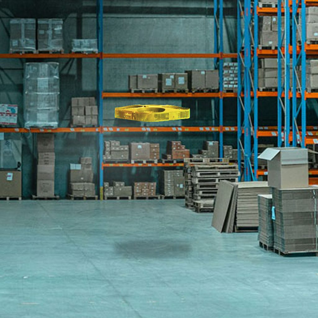
ZENADRONE IQ NANO
The ZenaDrone IQ Nano is specifically designed for indoor use, and is ideal for inventory management, warehouse mapping, operations monitoring, and security. Portable and durable, the IQ Nano is equipped with 4K cameras, barcode/QR code-scanning technology, and obstacle avoidance, and its data flow can be seamlessly integrated into existing warehouse management systems.